

U.S.-Based
Mission Planning Software Development
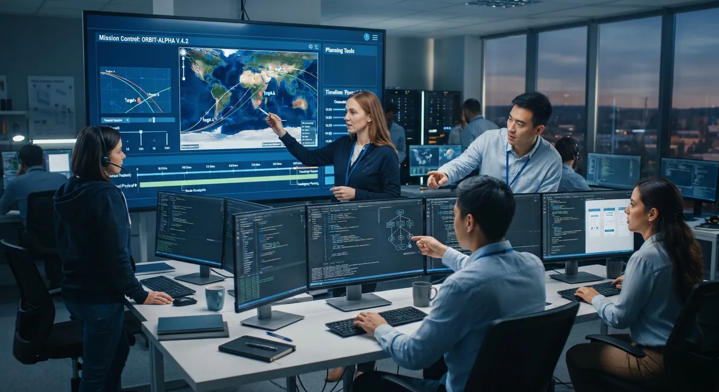
Mission planning software development by SoftDoes: collaborative tools that merge maps, weather, and airspace data into clear, shared plans.

Let's build together.
Talk with a senior engineer about your product idea, architecture, and what it would take to build it.
90+
Active Client Partnerships
80+ Person
Product & Engineering Team
100%
Your Code & IP Ownership
U.S.-Led
Delivery & Accountability
We understand the challenges you're facing
Why do our planners spend hours collecting maps, terrain, weather, airspace notices, and resource status from different sources before they can even start planning?
A custom mission planning platform pulls geospatial, terrain, weather, aeronautical, airspace, and resource data into one workspace that updates automatically. Instead of opening five portals and copying numbers into a spreadsheet, planners see every layer on a single map display with clear timestamps showing when each dataset was last refreshed. Mission planning software manages the design, calculation, and execution of operations; bringing these data sources together is the foundation. The software works with standard data formats: OGC map and terrain services (WMS/WMTS/WFS) for base maps, DTED and other elevation models for terrain, ARINC 424 for navigation data, AIXM for airspace structures and NOTAM data, GRIB and OPMET for weather, and MIL-STD-2525 / APP-6 for military symbology overlays. Using standardized data formats enables interoperability between third-party hardware and legacy systems, which matters when plans must move between organizations. Underneath, the mission data model defines consistent structures for missions, phases, tasks, routes, waypoints (fly-by, fly-through, loiter patterns with exit criteria), areas (search, restricted, hold), resources, constraints, timings, and approvals. SoftDoes designs data pipelines that pull new data, validate source authorities, check timestamps, flag stale layers, and make data currency visible to planners on map overlays and in data panels. Data quality and temporal consistency are critical in mission planning applications; a stale NOTAM or an expired airspace reservation can invalidate an entire route.
Several teams work on the same plan at once. How do we stop conflicting versions, missed changes, and last-minute surprises?
Collaboration starts with shared plans that support role-based editing, version history, and change tracking. Planners, safety officers, and commanders each see the same plan and can add comments, flag issues, and sign off through structured approval workflows. When one team modifies a route or shifts a timing window, the system runs automatic conflict checks against other routes, airspace reservations, and shared resources, then sends notifications so affected planners can resolve issues before they become surprises. The software supports NATO and national planning frameworks at the workflow level, with configurable steps and forms that mirror how the client's organization actually plans, without exposing tactics or operational details in the tool's structure. For coalition operations, plan data can be shared in standard formats such as NATO APP-11 messages and export packages aligned with Federated Mission Networking (FMN) principles, with controlled workspaces for different security domains. People remain in full control throughout. The software tracks inputs, surfaces conflicts, and facilitates coordination, but all mission decisions and approvals are made by planners and commanders. Human oversight is essential in mission planning software to ensure accountability and validate plans.
Our planning software must meet strict security requirements, and anything it sends to an aircraft or drone must be trusted. How do we prove that?
Security practices should include strong authentication and role-based access control, and the platform extends this with attribute-based access, encryption in transit and at rest where required, audit trails for every change, and integrity checks on mission data packages before they reach aircraft, unmanned aerial vehicles, vessels, or ground vehicles. Implementing zero-trust security measures is necessary in mission planning software; no component trusts another without verification. The relevant frameworks depend on the client's program. For DoD programs, that means the Risk Management Framework and ATO process, NIST SP 800-53 and 800-171 controls, CMMC 2.0 readiness, and DISA STIG-aligned hardening. For civil drone missions under FAA Part 107 or EASA UAS regulations, different compliance structures apply. Export controls such as ITAR and EAR are handled as specified by the client's export control plan. When mission plans feed onboard avionics or autopilot systems, SoftDoes works within software assurance and aeronautical data standards. Mission planning applications require rigorous safety standards adherence such as DO-178C for airborne software, while DO-200B (and the updated DO-200C released in June 2024) governs aeronautical data quality requirements including accuracy, resolution, timeliness, traceability, and assurance level. Safety-critical systems must maintain end-to-end traceability of requirements to implementation. SoftDoes works inside the client's security and certification framework. We do not claim clearances, approvals, or certifications we do not hold.
Can new planning software work with our existing platforms, data loaders, and C2 systems, or will we have to replace them?
The architecture is API-first. Mission plans export in formats that existing platforms and ground stations already accept, based on the client's interface control documents. Planners create the plan in one workspace; the system generates the correct export package for each platform without manual re-entry, reducing the data retyping errors that cause rejected loads or incorrect waypoints. Typical integrations include Esri ArcGIS or open-source GIS stacks (QGIS, CesiumJS), 3D terrain engines, TAK ecosystem tools, unmanned systems ground control stations using STANAG 4586 or MAVLink, and links to C2/C4ISR systems for handoff to execution and return of mission results. Open-source mission planning software supports MAVLink compatible drones; for example, Mission Planner, created by Michael Oborne in 2010 as open-source software for ArduPilot, provides complete functionality for vehicle setup and in-flight monitoring, while QGroundControl is the canonical flight planner for PX4. SoftDoes builds export adapters that work alongside these ecosystems rather than replacing them. Existing plan templates, route libraries, and reference data migrate into the new system through validated import tools, while legacy tools keep running during a phased rollout. SoftDoes engineers data translation adapters and validation tests so that plan packages can be trusted by both legacy loaders and new interfaces during transition.
Why does building and briefing a plan still take so many manual steps and slide decks?
SoftDoes conducts user research with planners, operators, pilots, team leaders, and decision makers (subject to client approval) to understand how they currently plan and brief missions. Human-centered design reduces cognitive load during high-stress operational phases; the interface must support speed without hiding information. Role-specific interfaces include a 2D/3D map workspace for route and area planning, synchronization timelines, Gantt-style views of asset usage, plan templates and checklists, and one-click generation of briefing packages with maps, timelines, route cards, comms plans, and constraints. Operators can visualize and edit flight plans during missions through the same workspace. Rehearsal and fly-through views (simulated route flyovers on 3D terrain) let teams walk through the plan before execution, and debrief tools compare what was planned to what actually happened using imported tracks and logs. SoftDoes UX practices include fast drag-and-drop editing, keyboard shortcuts for heavy users, tablet and laptop layouts for field use, offline operation on disconnected networks, and support for multiple languages for coalition planning cells. Allowing users to work with a user friendly interface that matches their role and expertise reduces training time and planning errors.
You plan the mission. We engineer the software behind it.

Custom mission planning platforms
Platforms that bring data, planning tools, coordination, and briefing together around the client's specific planning process, replacing scattered tools and manual slide decks with a complete planning environment. Main modules include a geospatial map and terrain workspace, route and timing planners, airspace and area management, asset and resource assignment, automated conflict checks, workflows for approval, briefing package generation, plan export to platforms, and debrief.
2D/3D mission workspace with terrain, weather, airspace, and resource overlays
Automatic route, timing, and resource deconfliction with clear alerts
One-click mission briefings and export packages ready for loaders and C2

Planning data services and integration
SoftDoes builds the data and integration foundation that reliable mission planning depends on: map and terrain services, aeronautical and weather feeds, reference libraries, and connections to platforms, ground stations, and C2 systems. This includes GIS servers (ArcGIS Server or open-source stacks), 3D terrain servers, data validation pipelines, transformation services between formats, and secure movement of data between networks using client-approved solutions.
Automatic navigation, airspace, and weather updates with visible currency checks.
Standards-based plan exchange with partner systems and coalition networks.
Import of executed mission tracks and logs for debrief and analytics.

AI-assisted planning
AI supports planners by suggesting route and timing options under constraints, checking plans for conflicts and missing steps, estimating fuel, battery, and time needs, drafting briefing summaries, and surfacing lessons from previous missions. AI can assist in mission planning by converting natural-language objectives into structured requirements, but planners review and approve every output. AI features are built under responsible AI principles (DoD AI Ethical Principles and NATO Principles of Responsible Use of AI), with explainable reasoning where possible, confidence levels, and human review.
Constraint-aware route and schedule options that planners can compare and refine.
Automated checks for gaps, conflicts, and policy violations before approval.
Search across past plans and debriefs to surface relevant lessons and patterns.
Numbers Don’t Lie
Recent projects showcasing how we design, engineer, and deliver production-ready software solutions.

- Startup
- Real Estate
Our Haus AI
A finance professional turned founder built Our Haus AI, an AI-powered collaborative workspace where homeowners and contractors scope, bid, contract, and document renovation projects together. SoftDoes took her prototype and made it production-ready.- 10XMVP scope delivered
- 2+years Ongoing partnership
- 1Fully owned Platform

- Finance
- Energy
Deepwater Insights
Deepwater Insights delivers proprietary alternative data and niche research on the offshore drilling and energy sector to institutional investors, family offices, and high-net-worth individuals who require coverage that larger firms don't provide.- 100%Brand Continuity
- 2Platform Distribution
- 100%Paywall-Ready Content

- Real Estate
The building buyer
The Building Buyer is a Florida-based real estate investment firm co-founded by Dylan Troiano and Charles Hanlin. They acquire single-family, multifamily, and commercial properties across South Florida and beyond, with a focus on motivated seller opportunities.- 18Weekly hours saved
- 2+Years Ongoing partnership
- 1Fully owned Platform

- Education
- Non-Profit
WOVEN & NICE
Woven is a Spring Valley, NY nonprofit running the NICE program (New Training Inclusive Community Environment) in four Rockland County schools. Their team supports students through restorative practices, mediation, and professional development for teachers and administrators.- 4Schools Served
- 4Weeks to Launch
- 1STTime on Upwork

- Healthcare
CareInTouch
CareInTouch is a Bay Area home health agency providing skilled nursing and therapy services to patients referred from hospitals and clinics. With over 100 staff, they operate in one of the most complex and compliance-driven healthcare markets in the country.- 40% Reduction In Billing Errors
- 100+Staff Operations Managed
- 0Missed Compliance Deadlines

- Startup
Sparkle The Cleaning Service
Sparkle The Cleaning Service is a Detroit-area residential cleaning company with 10 years in business, connecting homeowners with vetted, insured independent cleaners through a subscription-based marketplace platform.- 75% Platform Transparency
- 2XPlatform Growth
- 40%Higher User Retention

- Startup
DineMate
DineMate is a Maryland-based dating and connecting platform built around verified profiles, restaurant reservations, and prepaid dining experiences. Founded to bring back authenticity to how people meet and connect.- 60% Time Saved
- 99%System Reliability
- 40%Higher User Retention

- Healthcare
Prior Authorization AI
Prior Authorization AI is a healthcare automation startup building AI-powered tools to streamline prior authorization for Medicare and Medicaid medical transportation providers in New Jersey.- 16Weekly hours saved
- 63%Admin time reduced
- 43%Fewer submission errors

- Education
Grand Central Language Services
Grand Central Language Services provides translation and interpretation for organizations operating in complex, multilingual environments. As demand grew, internal workflows became harder to manage. SoftDoes built a custom platform to streamline coordination, improve visibility, and support scalable operations.- 72%Workflow Reduction
- 48%Coordination Reduction
- 83%Visibility Increase

- Healthcare
FMY Orthodontics
FMY Orthodontics, a multi-location practice in West Tennessee, partnered with SoftDoes to replace a spreadsheet-based financial workflow with a custom web platform. The goal was to simplify how staff present treatment financing while allowing patients and families to review and complete decisions remotely.- 60%Workflow Reduction
- 75%Remote Adoption
- 5Locations Aligned

Forbidden Alchemy
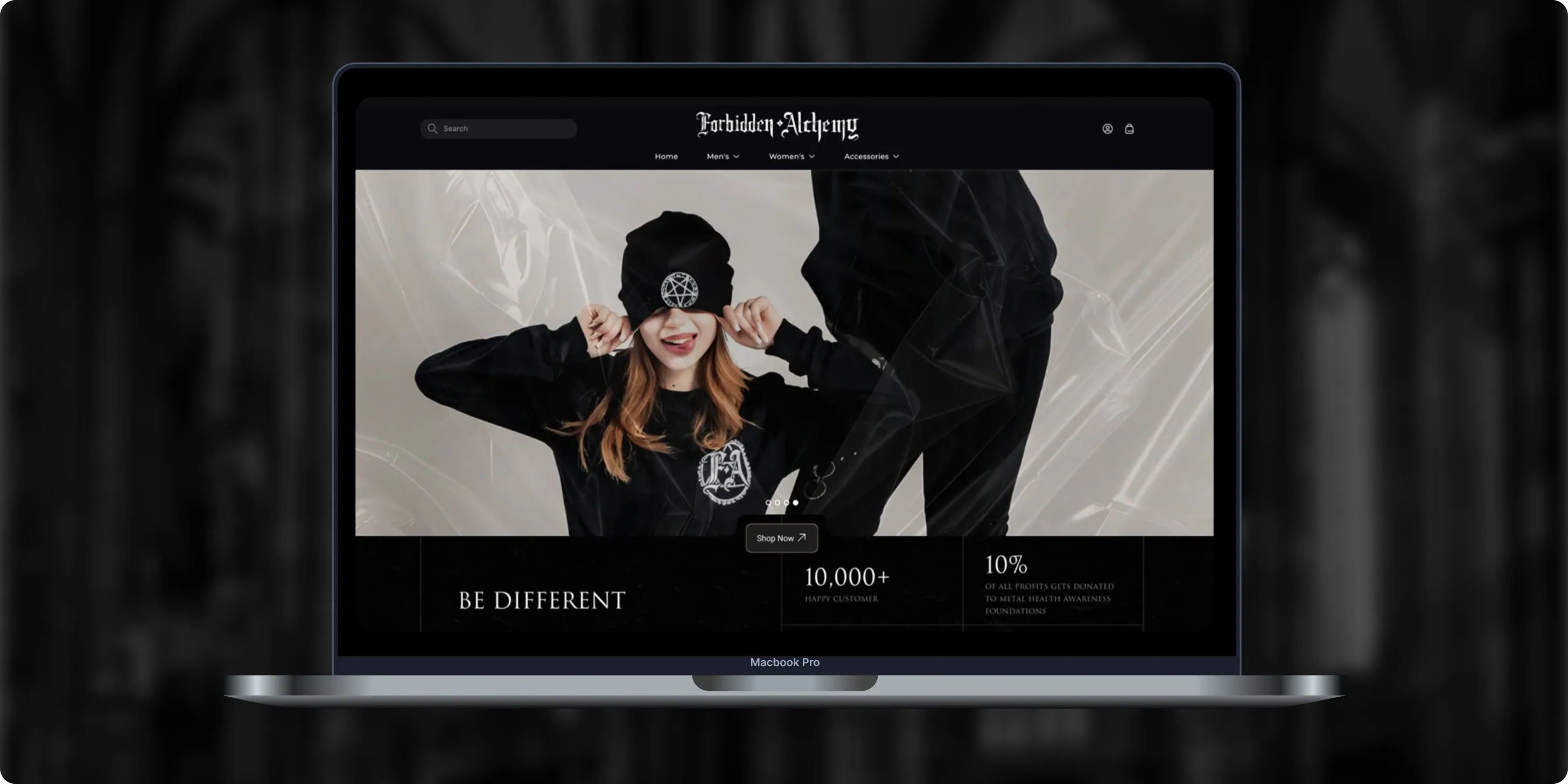
Forbidden Alchemy is an alternative fashion brand creating dark, provocative clothing for the metalhead community, with 10% of profits donated to mental health awareness. Its mostly mobile audience struggled with a store that was hard to navigate and weak on functionality.- +44%Revenue Month Over Month
- 86%Design Satisfaction
- 2.8XUser Retention Growth
Altera
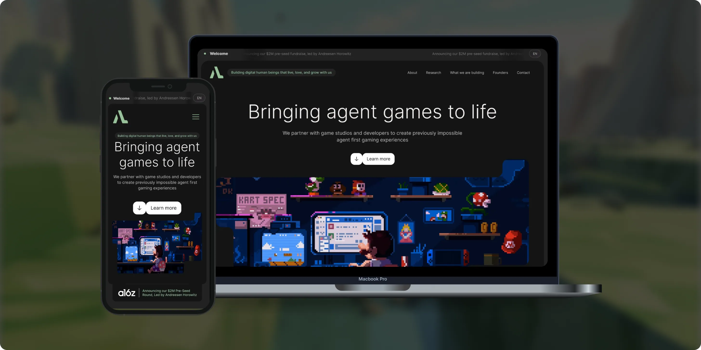
Altera builds on decades of computational neuroscience research to create digital human beings for gaming. Backed by a $2M pre-seed round led by Andreessen Horowitz, the team needed a landing page that could explain complex agent technology to players, partners, and investors.- 98%Dynamic Customization
- 100%Streamlined Navigation
- $2MPre-Seed Round
- Real Estate
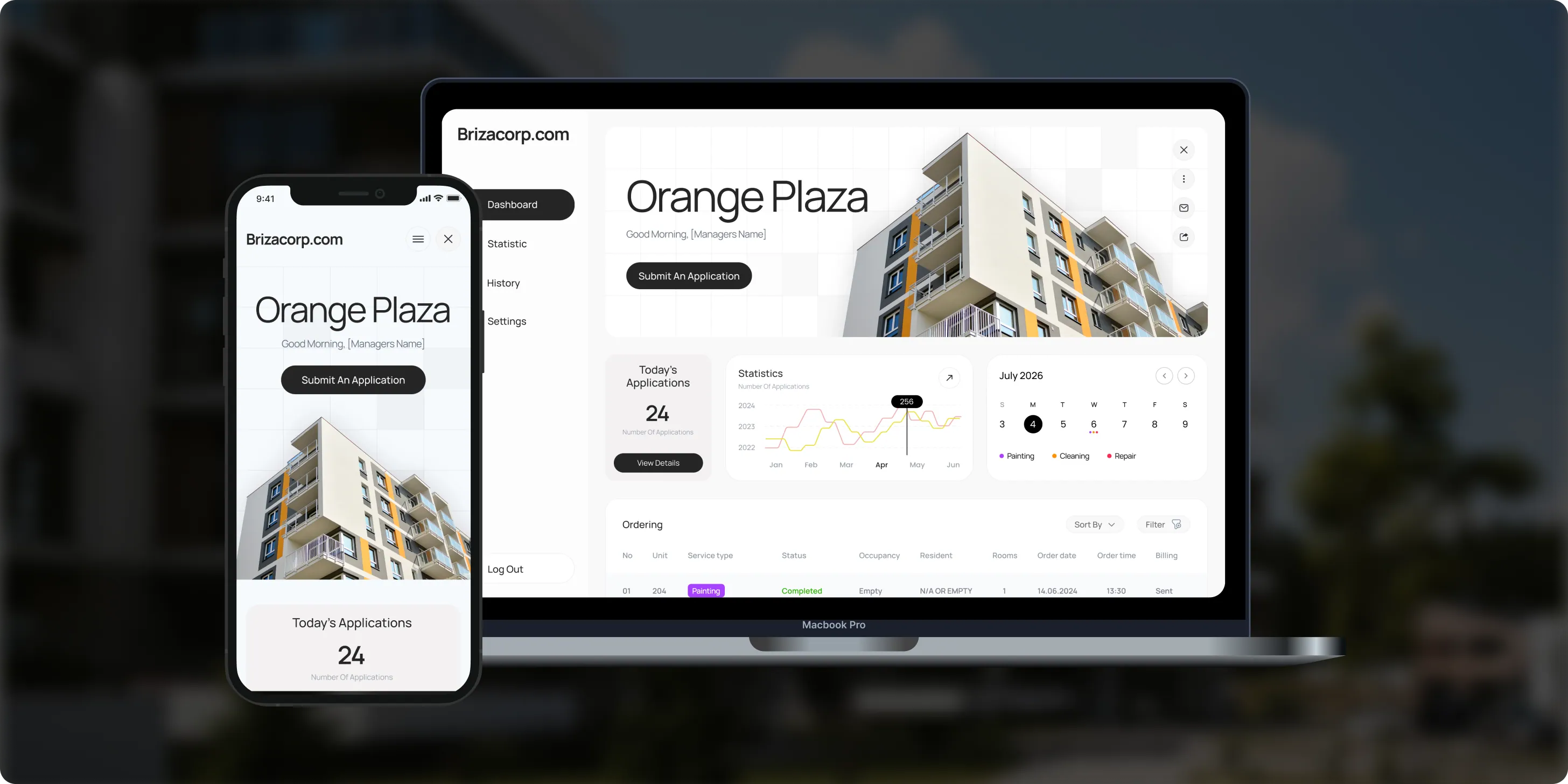
Brizacorp
Brizacorp manages residential properties and coordinates the staff who handle painting, cleaning, and repair requests. Its team tracked work across messengers, phone calls, e-mail, and paper planners, with no single place to manage requests or measure performance.- 98%Application Stability
- 95%Utilization Rate
- 30%Faster Task Completion
Color & Harmony
Color & Harmony is a Kentucky-based color consulting studio led by certified color strategist Diana Cartaya. The studio needed a website that reflects its refined aesthetic, showcases its portfolio, and explains a science-based color process in simple language.- 45%Conversion Rate Increase
- 50%Higher User Engagement
- 2Months to Launch

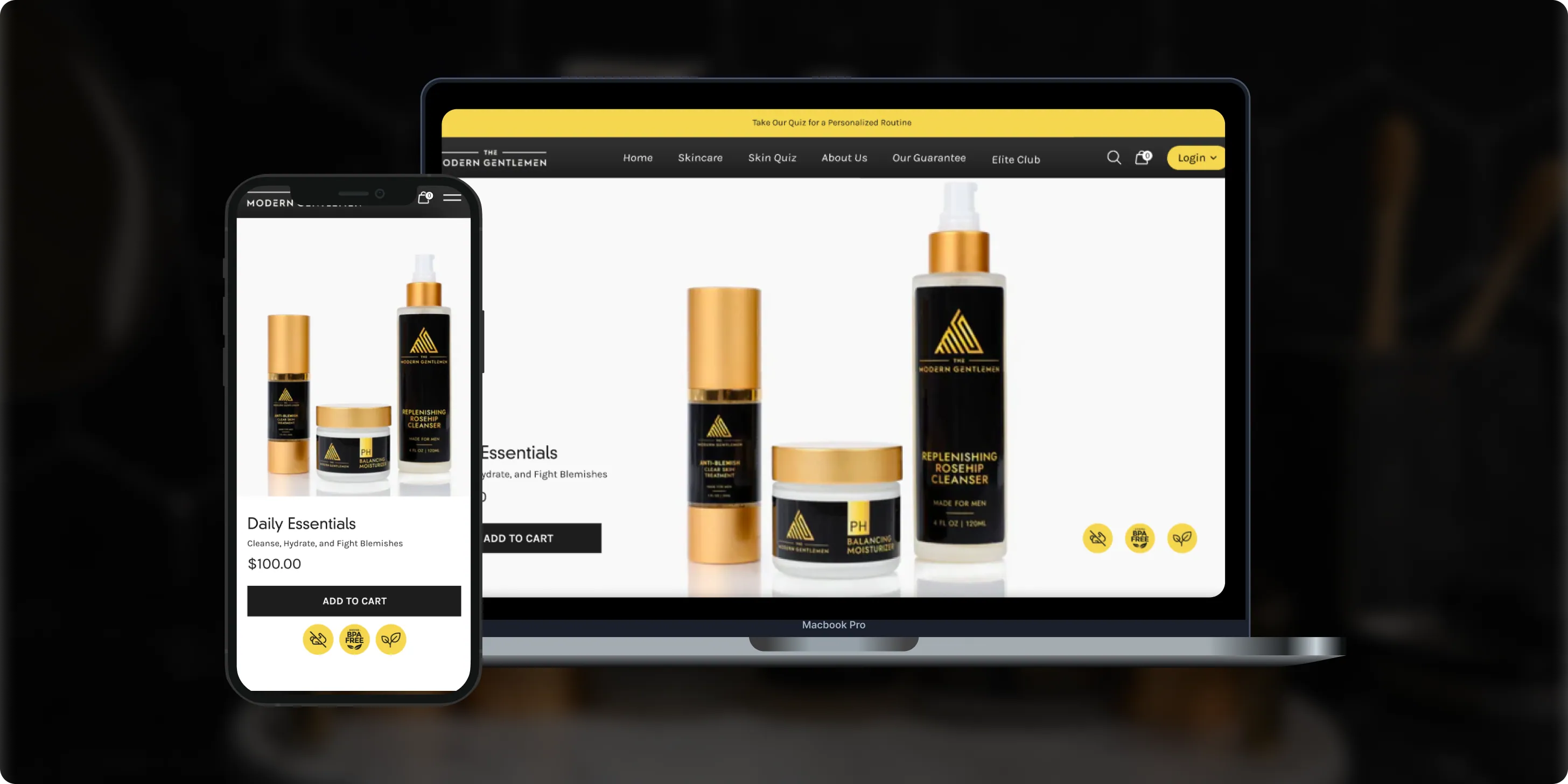
The Modern Gentlemen
The Modern Gentlemen sells premium men's skincare featured in Men's Health, GQ, and Men's Journal. Its customers wanted an efficient routine, but generic product suggestions and limited skincare knowledge made choosing the right products hard.- 30%Increase in Conversions
- 25%Higher Customer Retention
- 92%Mobile Purchases
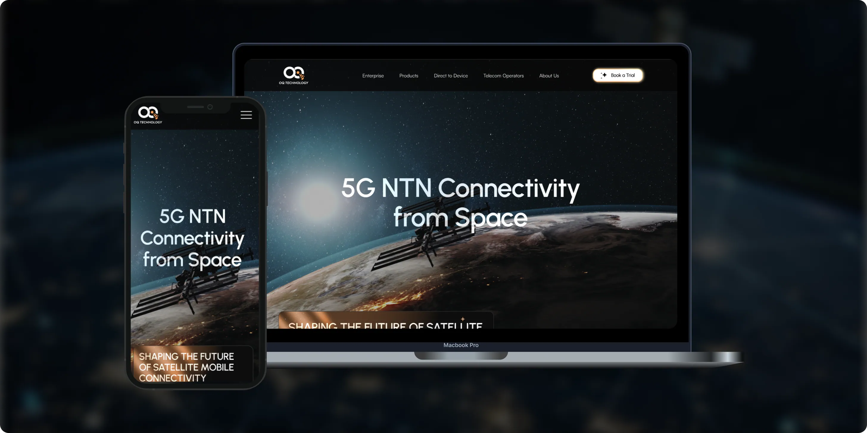
OQ Technology
OQ Technology connects IoT devices, machines, and people anywhere on the planet through its satellite network, serving energy, maritime, logistics, agriculture, and mobile operators. Its website made it hard to explore products and reach pricing plans.- 4Pricing Plans Clarified
- 3Dedicated User Flows
- 1Unified Platform
- Real Estate
- Finance
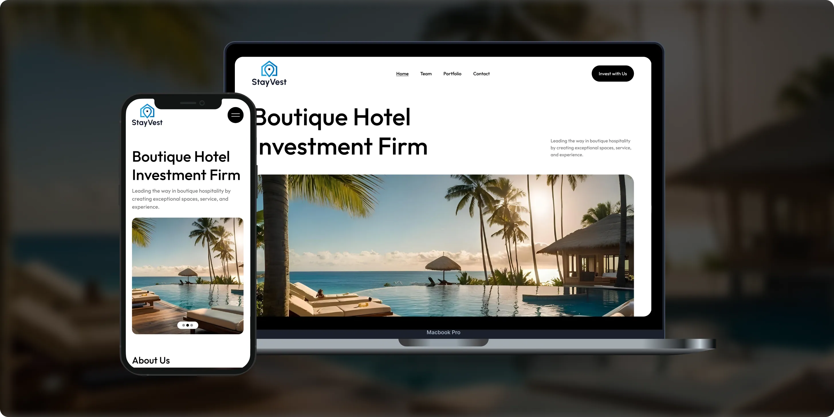
Stay Vest
Stay Vest is a private real estate investment firm that acquires, renovates, and operates boutique hotels for cash flow, tax benefits, and equity gain. It needed a platform that explains its strategy and earns the trust of passive investors.- 1,500+Guest Stays
- 200+Rooms Managed
- 5States Covered
Bokeyno Motorsports
Bokeyno Motorsports is the leading mobile installer of vertical doors for high-performance cars. This Shopify website isn’t just about services—it’s a bold statement of power, style, and expertise. With a sharp layout, strong visuals, and real-world case studies, the site delivers all the information car enthusiasts need to book confidently and instantly.- 54%Booking Requests
- 43%Lead Conversion
- 32%Qualified Inquiries

ai document processing platform
A comprehensive talent solution designed to help companies attract, hire, and retain top talent more effectively. The platform combines AI-powered recruitment technology with employee financial wellbeing programs, enabling smarter hiring decisions while supporting employees’ financial stability and long-term engagement.- 62%Faster Processing Time
- 78%Less Manual Work
- 35%Improved Accuracy

WHAT CLIENTS SAY
Independently verified reviews from real clients on Clutch.co


Client Story
Real feedback from
FMY Orthodontics

“Their perseverance and solution-oriented mindset. SoftDoes consistently found ways to make things work, added features we had not originally envisioned, and never became frustrated. It felt like working with a true partner who cared about the success of our practice.”
Dan Merwin
DDS, MS -- President, FMY Orthodontics

Client Story
Real feedback from
Prior Authorization AI
“Every time I sent a request, if there was anything that didn't work, they were able to turn it around quickly. Even when there were no updates yet, they always reached out to let me know they were working on it.”
Joseph Oluwo
Founder of Prior Authorization AI


Client Story
Real feedback from
WOVEN
“What stood out most was their commitment to understanding our needs before presenting solutions.”
Danna Pastran
Administrative Operations Manager, WOVEN

Client Story
Real feedback from
Grand Central Language Services
“The site performs as intended and provides the foundation for our company's digital presence.”
Joe Goldstein
QA Manager, Grand Central Language Services


Client Story
Real feedback from
DineMate
“They go above and beyond.”
Eric Snead
CEO, DineMate "Dating Connecting Platform"
Why they Choose SoftDoes
- 01SENIOR ENGINEERS, NOT LAYERS
SoftDoes mission planning projects are led by senior engineers and architects who have shipped geospatial systems, 3D visualization tools, collaborative editing platforms, and scheduling engines at scale. They read and interpret interface control documents, aeronautical and UAS data standards such as AIXM, ARINC 424, and STANAG 4586, and security and safety requirements, then turn them into concrete technical designs and data models. Client systems engineers, planning leads, and security teams communicate directly with the developers doing the work, so there is minimal loss of detail between requirements and implementation. SoftDoes teams discuss terrain rendering, aeronautical data handling, constraint solving for deconfliction, and concurrent editing semantics with the client's specialists at the level those topics demand.
- 02PREDICTABLE DELIVERY
SoftDoes delivers incrementally, aligned with the client's program milestones, integration events, exercises, and accreditation gates. Written specifications, a requirements traceability matrix that ties every feature back to planning workflows, and acceptance criteria defined with planners and systems engineers keep scope and progress visible. Regular demos using representative or sanitized mission data let stakeholders see real workflows early and adjust before large investments are locked in. Dependencies with platform teams, data providers, cyber and accreditation teams, and other suppliers are tracked and managed jointly rather than discovered at the end.
- 03BUILT TO LAST PAST LAUNCH
SoftDoes designs mission planning software as long-lived platforms, using modular, open architectures aligned with MOSA principles where applicable. Documented APIs, plug-in mechanisms for new aircraft, UAS types, sensors, and data sources, and clear separation between core domains (data services, planning logic, collaboration, export tooling) mean the system grows without rewrites. Built-in observability (logging, performance metrics, health checks on data feeds, and currency dashboards showing when navigation, airspace, and weather data are no longer current) keeps operators informed. Maintainability practices include code reviews, automated tests, SBOMs for software supply chain tracking, and DevSecOps pipelines that keep dependencies and security patches under control. Fault tolerance ensures systems can handle unexpected disruptions without failure, even when data feeds drop or network segments go offline.
- 04NO BABYSITTING REQUIRED
SoftDoes designs mission planning platforms so client teams can operate and evolve them without constant vendor intervention. Handover includes system and architecture documentation, admin and operator guides, runbooks, and training sessions for the client's engineers, administrators, and power users. Admin consoles let client staff manage users and roles, platform profiles, plan templates and checklists, reference data catalogs, and connections to data sources and partner systems. Ongoing partnership and support remain available, but the client is not locked into SoftDoes for everyday configuration or for adding new mission templates within the existing architecture.
How we work with your quality team
This is how SoftDoes partners with you from first conversation through long term support.




Experience Across Defense Aerospace, Unmanned Systems, Defense Tech, and Search and Rescue
SoftDoes builds mission planning software where data accuracy, shared situational understanding, and human decision-making are non-negotiable.
Command Control
Edge AI Software
ISR Software
Logistic Software
CyberSecurity
Complex systems, integrations, and internal platforms built to evolve. We step in when off-the-shelf tools stop being enough.
Training Simulation
From first version to real traction without painting yourself into a corner. Built for speed now and hard decisions later.
Mission Critical
Systems designed around controls, traceability, and change management. Built so audits don’t become fire drills.
Defense Software
Infrastructure software built for long timelines and high stakes. Reliable systems for assets that can’t afford guesswork.


Frequently Asked Questions
Everything you need to know about working with SoftDoes. Can’t find an answer?
How long does mission planning software development take, and what drives the cost?
First useful increments of a focused tool (a UAS route planner or briefing package generator, for example) typically take several months. Full collaborative planning platforms with data services, conflict checks, multi-platform export, and debrief features are delivered in staged releases over longer periods, with each release adding capabilities against a prioritized backlog. Main cost and schedule drivers include the number and complexity of platforms and interfaces, diversity of data types, need for 3D visualization, security and safety requirements, and AI features. Access to interface documents, representative data, and client approvals often impacts schedule as much as the engineering work itself.
How is mission planning software different from C2 software?
Mission planning software covers preparing, coordinating, briefing, and reviewing missions. C2 (C4ISR) software supports live monitoring and coordination during execution. The two should share data: plans created in the planning system are passed to C2 for execution, and executed mission data (tracks, logs, status reports) returns for debrief and analysis. SoftDoes covers C2/C4ISR software development on a separate page. Mission planning applications must convert high-level objectives into executable paths; C2 software then manages those paths in real time.
Can the software support our platforms and existing data loaders?
SoftDoes bases plan export formats on the client's platform and ground station interface specifications, so mission data can be loaded without changing existing data loaders or hardware. Plug-in patterns allow adding new platform profiles and export formats without changing the system core. Existing plan templates, route libraries, and reference data migrate through validated import tools, with checks that confirm data integrity at each step.
How do you handle security, data integrity, and certification?
Security is built in through access control, encryption where required, audit logs, and integrity checks on every plan exported to a platform. These controls are designed to support frameworks such as RMF, NIST SP 800-53, and CMMC 2.0 where relevant to the client's program. When planning outputs feed avionics or safety-critical systems, SoftDoes follows the client's software assurance and data quality plans, which may reference standards such as DO-178C and DO-200B. The highest priorities in mission planning software include establishing correctness, trust, and resilience. SoftDoes does not claim security clearances, certifications, or registrations unless they are actually held and documented.
Who owns the source code, data, and intellectual property?
Ownership is defined in the contract and can be structured so the client, and where needed its government customer, receives full rights to deliverables. SoftDoes documents third-party and open-source components, including generating SBOMs so license terms are clear. Handover includes source code, infrastructure-as-code where applicable, build pipelines, and complete documentation so the client can maintain and extend the system with its own developers or another partner.
How is AI used responsibly in mission planning?
AI in mission planning software suggests options and checks plans; it does not make operational decisions. Planners always review and approve outputs. Features include explainable recommendations where possible, confidence indicators, and visibility into which constraints drove a suggestion. SoftDoes aligns AI features with frameworks such as the DoD AI Ethical Principles, NATO Principles of Responsible Use of AI, and, for programs where it applies, DoD Directive 3000.09, with testing on representative scenarios and ongoing monitoring of AI performance.
Can the software work offline and in the field?
Mission planning tools can be deployed on laptops and tablets with local caches of maps, terrain, and reference data, allowing planners to conduct planning in disconnected environments. When connectivity is restored, plans and data synchronize with conflict handling for edits made in parallel at different locations. Mission Planner provides tools for emergency landing commands even in low-connectivity conditions. Support after delivery includes regular data and software updates, security patching, sustainment agreements, and training for client technical staff.
How do you reduce risk on a mission planning software development program?
SoftDoes reduces risk through incremental delivery, early prototypes with sanitized data, starting with one platform before expanding, and involving security, safety, and test teams from the outset. Automated and regression testing, validation of exports against platform ICDs, configuration management, and rollback plans for deployments provide technical risk control. Transparent reporting of risks, issues, and technical trade-offs gives program leaders the details they need to make informed decisions throughout the project.